Blog

  • Old School House

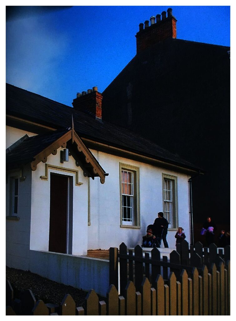
    The listed Old School Building (1845) been restored with Heritage Lottery funding and the support of the local community. It is said that the wonderful roof timbers were taken from the then redundant Old Priory, which you have already visited. It is now a resource for all and is used for meetings, concerts, the scouts, family parties and much more.

  • Parish Church of St Philip & St James

    Opposite the Old School is the Parish Church of St Philip and St James. The overcrowding in the Old Priory Church in the late 1830s had forced the Church of Ireland to seek alternative accommodation and the decision was made to erect a completely new Parish Church here was taken in April 1842.

    Charles Lanyon who was already undertaking a major Church building programme for the Diocese of Down, Connor & Dromore was appointed as the architect.  The new Church was consecrated in 1844. However it also became too small for the rapidly expanding town and in 1869 it was enlarged by building a new nave and north aisle and converting the original structure into the south aisles That is why the tower and spire are at the end of what is now an aisle, instead of the more usual position at the end of the nave. If you walk round to the far side of the Church the difference between the original and the extension is clear to see.

  • Holywood Motte

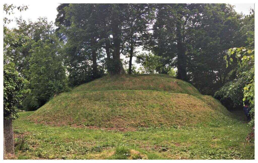
    When the Normans invaded Ulster in the 12th century fortifications such as Holywood Motte were widely seen across the land. King John passed through Holywood in 1210 on his journey from Carrickfergus to Dublin. He is said to have “spent the night” of Thursday July 29 in the Government Bailey situated on the Motte before heading on to Dundonald by way of Victoria Road and Croft Road (formally King John’s Highway) to stay at Dundonald Motte (where he lost 2 pence playing cards!).

  • Johnny the Jig Statue

    The statue is the work of local sculptress Sophia Rosamond Praeger. Her delightful bronze statue of a youngster playing the accordion was cast as a gift to the town and erected in 1953. The original sculpture in the North Down Museum in Bangor was created to commemorate a local Boy Scout named Fergus Morton who was killed in a road accident while doing ‘Bob a Job’ in 1952.

    Beside the statue is a blue plaque to commemorate the birthplace of Robert Sullivan, one of Irelands outstanding educationalists.

  • Holywood Old Priory

    The town’s rich ecclesiastical heritage is represented today by its most distinctive building, the Old Priory. The site was formally a monastery founded by St Laiseran in the early 7th century. The ruins you see today are that of the 12th century Anglo-Norman Augustinian Abbey. Henry VIII dissolved the Priory in 1541 with its lands passing into the hands of the O’Neill family and then to Sir James Hamilton, First Viscount Clandeboye. Hamilton laid out the town, with a Maypole at the crossroads and most of the early buildings are clustered round the Priory. The tower, however, dates from 1809 (the date marked on the original clock now in the current Parish Church) when this was the site of the town’s Parish Church. The graveyard has some interesting “residents” including members of the Praeger family, the Dunvilles (of whiskey fame) and Sir Joseph Larmor the world famous mathematician.
    When facing the Priory, across the road on your right, you will see First Holywood Presbyterian Church (1842).

  • Holywood’s Maypole

    Holywood’s Maypole is the only one surviving in Ireland today and early maps show a Maypole has stood on the site since the 1620’s. Today it is still the focus of the town’s annual May Day Celebrations and fair, when local school children dance around the Maypole alongside market stalls and family attractions.

  • Redburn Country Park Walk


    Please reuse this map but first see: https://www.openstreetmap.org/copyright

    The designation ‘Country Park’ suggests an accessible woodland on the urban fringe suitable for a gentle stroll. Redburn is not really like that and I have included 5m contours on the map above to make this clear. Any looped walk here will involve well over 100 metres of climb – a third of an Irish mountain and a significant workout for lungs, heart and legs! If you are of modest fitness be aware, take your time and pack in lots of stops to enjoy the great views which come with height and effort!

    (more…)
  • Time and Tides

    A number of the walks described in this blog follow the coast and therefore will be impacted on by the tides. The tide cycle will almost always affect the opportunities for wildlife spotting and change the coastal landscape. However, in extreme cases, they may make certain routes impossible or ill advised.

    Bearing in mind the general dearth of rights of way for the foot traveller in NI, you will often find yourself relegated to the foreshore, the strip of land between spring low and high tides. Generally this is crown property and public access is permitted. However, by definition, there will be times at high tide (and onshore strong winds)  when access is impossible or at least ill-advised. Hence, when walking on the coast check the tides and avoid walks which are limited to the foreshore in places at high spring tides or in high winds.

    Checking the tides in advance is much easier nowadays with online tidal predictions readily available either on the web or via smartphone apps. Free data tends to be limited to about a week ahead so if you are arranging a walk some time in the future you may need to use  a paid service.

    Finally, tidal predictions will be for specific ports and not individual points on the coast. As high tide times can vary substantially along the coast it is wise to check times for points either side of your walk unless your are close to a listed port.

    I have found the websites / apps below useful in the past (please note this is not a ‘product endorsement’- see our post on “Opinions not Endorsements”  for further explanation of this issue).