
Please reuse this map but first see: https://www.openstreetmap.org/copyright
The designation ‘Country Park’ suggests an accessible woodland on the urban fringe suitable for a gentle stroll. Redburn is not really like that and I have included 5m contours on the map above to make this clear. Any looped walk here will involve well over 100 metres of climb – a third of an Irish mountain and a significant workout for lungs, heart and legs! If you are of modest fitness be aware, take your time and pack in lots of stops to enjoy the great views which come with height and effort!

Redburn has two car parks as well as pedestrian access from Demesne Road, by the old Gate Lodge, at the edge of Holywood. This route starts from the central car park whose location lends itself to walking loops. The route described is only one of many permutations and leaves many paths untrodden for a future visit. However, it attempts to both give a good overview of the obvious delights of Redburn and include options for less visited paths which might be new to some regular visitors.
| TYPE | Circular walk climbing steeply through woodland to open heathland with great views over Belfast Lough and city. |
|---|---|
| DISTANCE | 2.6 miles / 4.2 km |
| SURFACES | Mostly well made compacted surfaces with variable slopes. The optional section uses informal paths which can be wet and muddy. |
| HEIGHT GAIN / LOSS | 400 feet climb |
| HAZARDS | Some steep slopes, steps and uneven paths. Off-path options through rough areas with fallen trees and branches |
The Route
The route flows clockwise and packs most of the steep climb into the first 1/3 of the distance – the descent being much more gradual and easy on the knees. Some walkers might wish to reverse this!
Leave the car park from the upper right corner and bear immediately right onto a broad path which climbs steeply along the high fenced boundary of the park. After a short distance you will cross a small stream which cascades down a series of waterfalls from the deciduous woodland above.

The tightly packed contours on the route map indicate this is a tough section – pace yourself, have a break if you need it, breathe deeply and enjoy the climb! Careful study of the map contours will allow you to identity paths of varying steepness and plan your own variations.

When you arrive at the path junction turn left onto a more gently climbing track. Follow along across a small bridge until you recross the waterfall stream – this time tumbling down a small gully close to the forest edge and farmland.

Cross the gully here on the new bridge. Above you will also see a disused wooden staircase ascending the right side of the valley – a questionable earlier attempt to ‘improve’ the old earth and stone stepped pathway,
You now come out of the forest onto semi-open land and get your first clear view over Palace Barracks, the harbour estate and Belfast Lough.
The vegetation here is a rich mixture of spreading scrub separated with blocks of bracken and grassy areas. The path now climbs with the stream gully on your right and the open ground on your left.

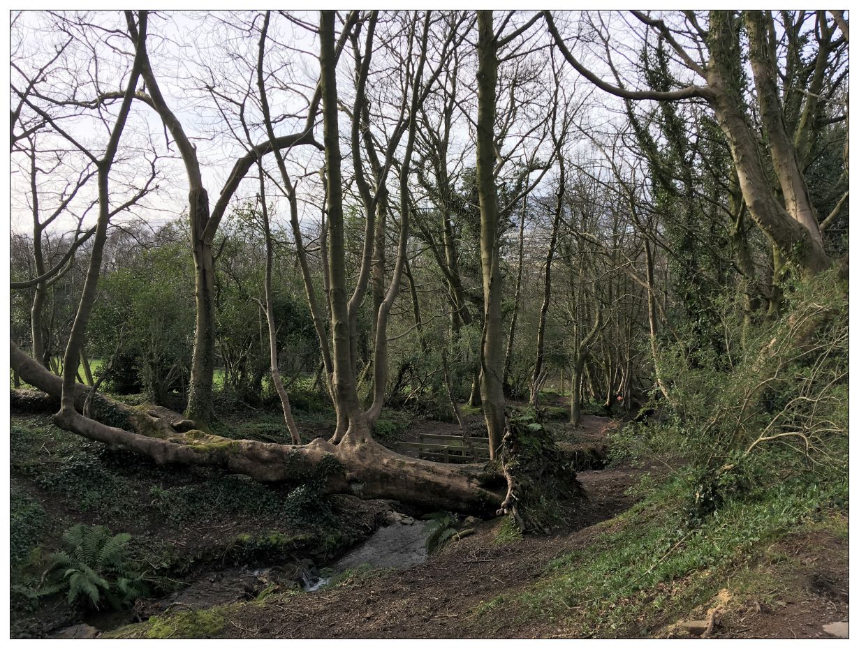
At the top of the slope you re-enter the wood over a bridge and the path turns sharp left. The minor path route here (marked with the orange arrow in the picture above) exits uphill to the right. If conditions are very wet this path can be muddy and soft in places so it is best to minimise your impact and stay on the main path instead (see map). Either path will take you up to the high open ground.

Assuming you are on the minor path you will find yourself twisting uphill close to the forest edge and farmland.

Woodland edges are often special places. Old trees and natural scrub tend to be left here, even if the rest of the wood is felled for timber, so they can provide shelter for new planting. There is extra light from the open farmland and they form a habitat edge where interesting things occur. This certainly applies in this section of Redburn – so keep your eyes and ears well open!


There is a richness of tree species here including mature towering Scots Pines.
As the path levels off it bends left and runs around beside a field edge. At one point it passes between a strainer fence post and the field corner just before splitting in two.

You have now entered an area of very young woodland. Deadnought Wood was planted in 2005 by the Woodland Trust to commemorate the 200th anniversary of the Battle of Trafalgar and Nelson’s fleet of oak ships. It contrasts sharply with the old woodland you have just left but is full of interest in its own right and well worth an explore along its network of paths (it is also relatively flat!)

The small path soon joins a much broader grassy vehicle-width track. Turn left and in a few steps you will find yourself emerging high above Belfast Lough.
Now bear right cutting diagonally across the open grassland to join the surfaced path which follows level along the skyline route. The views here are magnificent and on a clear day Slemish Mountain is visible to the North West and Scotland to the East.

For the next 300m you get to walk along the level edge of the Belfast Hills skyline. A full loop around the hills which surround Belfast is about 25 miles – but only tiny sections of this are currently accessible to the public. So make the best of the Redburn skyline and hope for better things to come in the future!

At the end of the level view walk comes another path junction. Bear right here to where a footbridge crosses the head of another stream valley and then follow the path downstream with farmland on your right and a rapidly deepening stream gorge on your left. You are passing into an area of long established woodland – so look out for tell-tail Bluebell plant leaves in the valley below.
This is Nun’s Wood, the oldest woodland in Redburn Country Park. It once marked the upper boundary of the demesne of Holywood House, which stretched from here all the way to the edge of Belfast Lough. Its big house stood within the area now bounded by Abbey Ring Road. Holywood Demesne today only exists as an electoral ward name.

After about 100m the path turns away from the stream valley and proceeds to twist and contour along the top edge of the wood. This area has much greater diversity of tree types, ages and ground cover than the much more formally planted beech plantations of the middle section of Redburn.
After 400m a corner cutting broad track runs directly downhill on your left. I suggest sticking to the old path straight ahead when you will be rewarded by a visit to a bluebell glade with a guardian keeping watch.

Shortly after the glade the path comes to a hair-pin and doubles back on itself, now dropping down towards Holywood Golf Course below.

The wood here is diverse and seems disorganised (to our eyes) – but in reality the trees and plants are exactly where they want to be, based on their needs for light, moisture, shelter and soil type.
Watch out for an old hedge boundary running uphill (just before crossing the stream gully) which marks a sharp transition out of Nun’s Wood back to the ‘new’ planted Beechlands of Ardtullagh and Redburn.

After the stream gully you join a descending path and come to an old quarry which is said to have once served as a bear enclosure. The Dunvilles of Redburn family had eccentric hobbies and these included collecting exotic animals. Their menagerie was eventually donated to the city of Belfast and formed the beginnings of the Municipal Zoo.

Immediately past the Bear Pit a small neglected path branches uphill, cutting a nice line into the slope. I suggest this is a superior option to staying on the main path below.
As you begin to ascend look down to your right and you will see a striking hedge of tightly planted twisted beeches – slightly reminiscent of the famous ‘dark hedges’ of Co. Antrim. These mark the garden’s edge of Ardtullagh House which once stood on a level area just below to the right. The gatehouse still stands today at the far end of Ardtullagh Avenue (see map).

As you climb here the path cuts into the slope – there is a sense of being in the beechwood – rather that just walking through it.
After about a 100m you cross a small, but solid, wooden bridge followed by a shallow quarry-like space which forms a hidden hollow away from the thoroughfare below.

The path now broadens and descends steadily to converge with the main route. Rejoin and shortly afterwards bear right sharply downhill (ignoring the broad path cutting left uphill). Then, almost immediately turn left where a level smaller path cuts off over a stone slab ‘bridge’.

Follow this path for 200m through dark laurel based shrubberies to where it breaks out of the the bushes to your final viewing point over the edges of Holywood and your starting point – the car park just below.
